Ai Synthesis

"satellite data"

Satellite Data — Thematic Core Service
TCS

Satellite Data

TCS Satellite Data aims at implementing satellite Earth Observation (EO) services transverse to the large EPOS community and suitable to be used in several solid Earth science application scenarios.
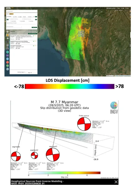
Satellite data products on 28 March earthquake in Myanmar available through EPOS Platform
News

Satellite data products on 28 March earthquake in Myanmar available through EPOS Platform

TCS Satellite Data co-seismic DInSAR products on the 7.7 earthquake occurred in Myanmar on 28/03 are available on the EPOS Platform.

News

Apr 14, 2025
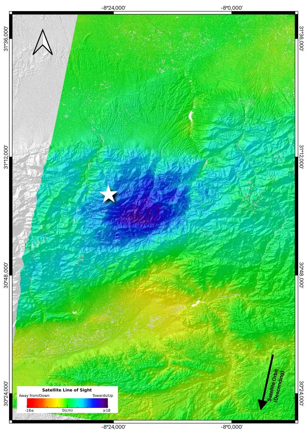
The EPOS data satellite thematic services allow mapping and studying the recent Morocco earthquake
News

The EPOS data satellite thematic services allow mapping and studying the recent Morocco earthquake

Thanks to an automated processing system developed in the framework of the “Satellite data” thematic services, it's now possible to provide valuable scientific insight on dramatic phenomena such as the earthquake in Morocco

News

Sep 13, 2023
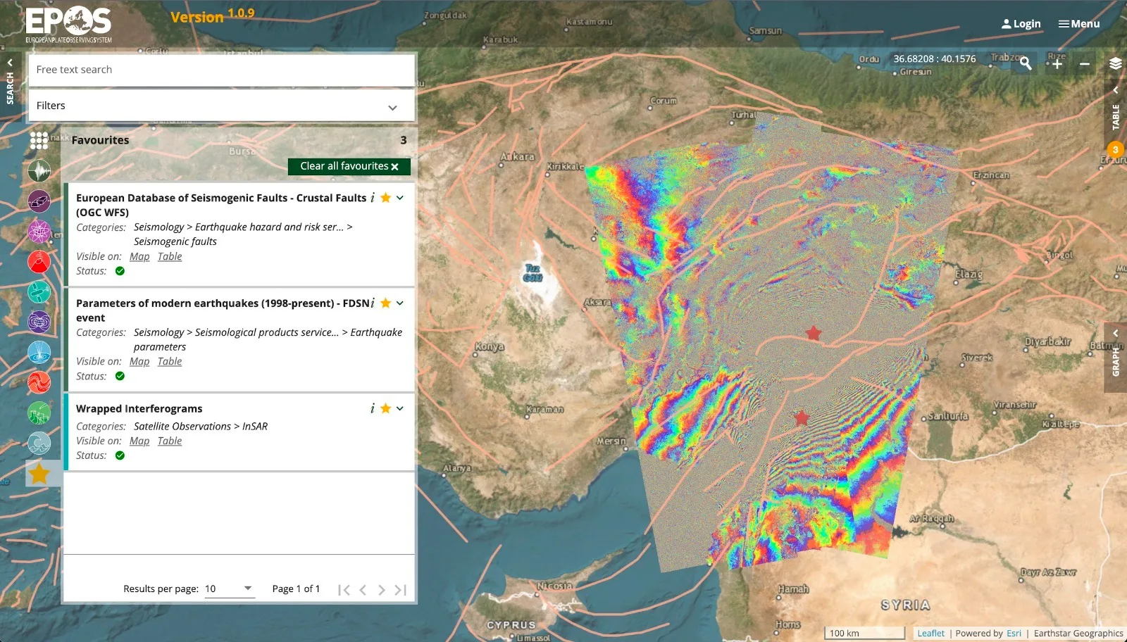
EPOS TCS Satellite Data have detected the surface deformation field in Turkey-Siria earthquake
News

EPOS TCS Satellite Data have detected the surface deformation field in Turkey-Siria earthquake

Following the two seismic events of February 6, 2023, that devastated South-East Turkey and Northern Syria, the researchers of the EPOS TCS Satellite Data have detected the surface deformation field.

News

Feb 16, 2023
EPOS launches the European Portal for Open and Integrated Access to Multidisciplinary Scientific Data for Solid Earth Sciences
News

EPOS launches the European Portal for Open and Integrated Access to Multidisciplinary Scientific Data for Solid Earth Sciences

The platform “EPOS Data Portal” will be presented at the EGU General Assembly 2023 and will allow scientists, students and stakeholders to access multidisciplinary scientific data and products for understanding Earth dynamics [Rome, 19ht A…

News

Apr 19, 2023
Near-Fault Observatories — Thematic Core Service
TCS

Near-Fault Observatories

A long term research infrastructures striving to provide such high resolution near fault data and products.

Internal pages

Community Portals

Within EPOS' framework, each Thematic Core Service (TCS) provides community-specific portals, where users can find a wide variety of data and other resources related to the Solid Earth Sciences.

Internal pages

Sep 14, 2026
GNSS Data and Products — Thematic Core Service
TCS

GNSS Data and Products

The TCS GNSS Data and Products provides access to data, metadata, scientific products and services, through the EPOS infrastructure, to foster research on geodesy and solid Earth science.

Earth & Space Observation — thematic area
Thematic Area

Earth & Space Observation

How the Earth is measured, from the ground and from orbit: geodetic networks, satellite missions and geomagnetic observatories, and the data products derived from them.

Geomagnetic Observations — Thematic Core Service
TCS

Geomagnetic Observations

The TCS Geomagnetic Observations consolidates data and services provided by the geodetic community and creates new services for magnetotelluric data and geomagnetic models.

Volcano Observations — Thematic Core Service
TCS

Volcano Observations

The Volcano Observations (VO-TCS) provide long-term access to the Volcano Observatories and Research Institutions data and products. VO-TCS aims at implementing facilities allowing easy access to volcanological data and interoperable servi…

Internal pages

Stakeholders

EPOS will create an internationally recognised European research infrastructure that will open new horizons for European research in solid Earth science. Seamless access to national and European data and services will attract a variety of…

Internal pages

Sep 15, 2026

Satellite Observations

The document outlines the Satellite Data Thematic Core Service (TCS), a platform that collects, processes, and integrates satellite data to advance Earth science research. It highlights the role of satellite observations in monitoring tect…

Presentation

Jan, 2022

EPOS TCS Flyer SATELLITE 2025

EPOS SATELLITE Data TCS Flyer 2025 highlights the role of satellite data in advancing Earth science. The SATELLITE DATA TCS leverages radar systems from the European Copernicus Program to monitor surface deformation caused by geodynamic pr…

Brochure

Mar, 2025

2025 EPOS TCS FLYER SATELLITE 2025 ready-cut

EPOS SATELLITE DATA TCS leverages satellite measurements to advance research on Earth’s surface deformation and geodynamic processes. Using radar systems from the European Copernicus Program, it collects and integrates data to monitor tect…

Brochure

Mar, 2025

EPOS TCS 12 2022 Satellite

The SATELLITE DATA TCS within the EPOS framework leverages satellite radar data to monitor Earth’s surface deformation with centimeter precision, enabling advanced studies of tectonic processes and geodynamic phenomena. By integrating InSA…

Brochure

May, 2022

Open call for proposals for the International Conference on Research Infrastructures 2022 satellite and side events
News

Open call for proposals for the International Conference on Research Infrastructures 2022 satellite and side events

The call for proposals for the ICRI 2022 satellite and side events is now open.

News

Feb 3, 2022

Identification of the ground movements caused by mining-induced seismicity with the satellite interferometry

R Hejmanowski

Proceedings of the International Association of Hydrological Sciences

Publication

Apr 1, 2020