Satellite Data

The TCS Satellite Data main goal is to guide the European satellite Earth Observation community in order to create and support state-of-art satellite services and products suitable and useful to be exploited in the solid Earth science framework.

About

Satellite-based Earth observations have transformed geosciences, enabling precise monitoring of ground deformation and tectonic processes. Radar techniques, such as those from the Copernicus (https://www.copernicus.eu/en) Sentinel-1 constellation , provide critical data for studying seismic and volcanic activities.

Infrastructure and Collaborative Framework
The TCS Satellite Data collaborates with the European Space Agency (ESA) and the Geohazards Thematic Exploitation Platform (GEP) to harmonize and integrate satellite measurements. This partnership ensures accessibility and user-driven exploitation of satellite data.

Applications and Societal Impact
Satellite data supports earthquake, landslide, and volcanic hazard assessments, improving real-time monitoring and risk analysis and management. These capabilities benefit decision-makers and societies by enhancing disaster preparedness and response efforts.

Tools and Platforms
TCS Satellite Data offers tools for discovering, downloading, and processing satellite datasets. Platforms like GEP provide user-friendly environments for visualizing and analyzing Earth observation data, fostering multidisciplinary research.

Future Goals and Aspirations
The TCS Satellite Data aims to expand data integration, enhance user tools, and strengthen collaborations with national space agencies. Advancing satellite-based geoscience research will improve understanding and mitigation of natural and anthropic hazards.
Read more

Data & Services

Geohazards Exploitation Platform

The Geohazards Thematic Exploitation Platform (GEP) aims to support the exploitation of satellite Earth Observations (EO) for geohazards. GEP not only allows discovering and collecting EO data and products, but also provides systematic and on-demand services for processing EO data, and provides a social platform for users to interact with different communities. The TCS service providers benefit from a cloud-based environment, designed with a user-driven approach to implementing remote sensing services.


The Geobrowser of GEP represents the gateway of the TCS Satellite Data. Two levels of services are provided by the TCS Satellite Data within the GEP platform: the first level deals with “standard” remote sensing products, such as the displacement maps and deformation time-series; the second level concerns value-added products, such as 3D maps, source mechanisms, and fault models.


In particular, the TCS Satellite Data deploys four services, each one related to a different provider and a specific National Research Infrastructure:

  • EPOSAR (CNR, Italy) allows both on demand and automatic generation of ground displacement maps and time series;
  • GDM (CNRS, France) offers on-demand computation services on radar and optical imagery to produce horizontal deformation maps;
  • 3D-Def (CSIC, Spain) offers services of geodesy, gravimetry and geomathematics;
  • COMET (University of Leeds, UK) routinely processes EU Copernicus Sentinel-1 interferograms over tectonic and volcanic areas and makes them available through EPOS.

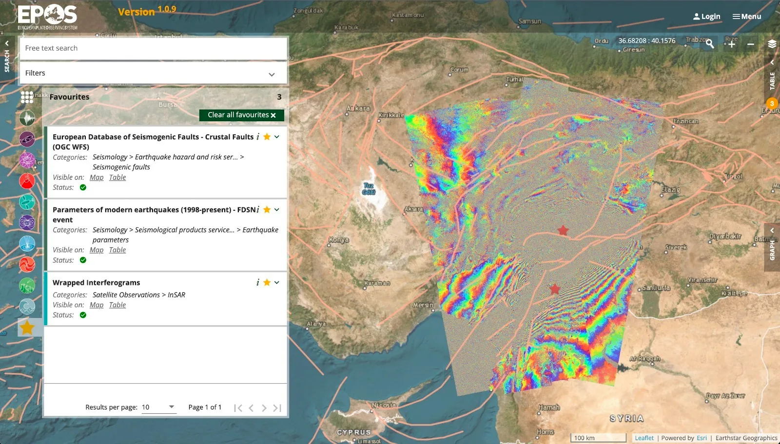
Geobrowser of the Geohazards Exploitation Platform that will represent the gateway of the TCS Satellite Data. The figure shows an example of the TCS products accessible through the GEP and is relevant to the displacement time series generated by the EPOSAR service in Italy.

Read more
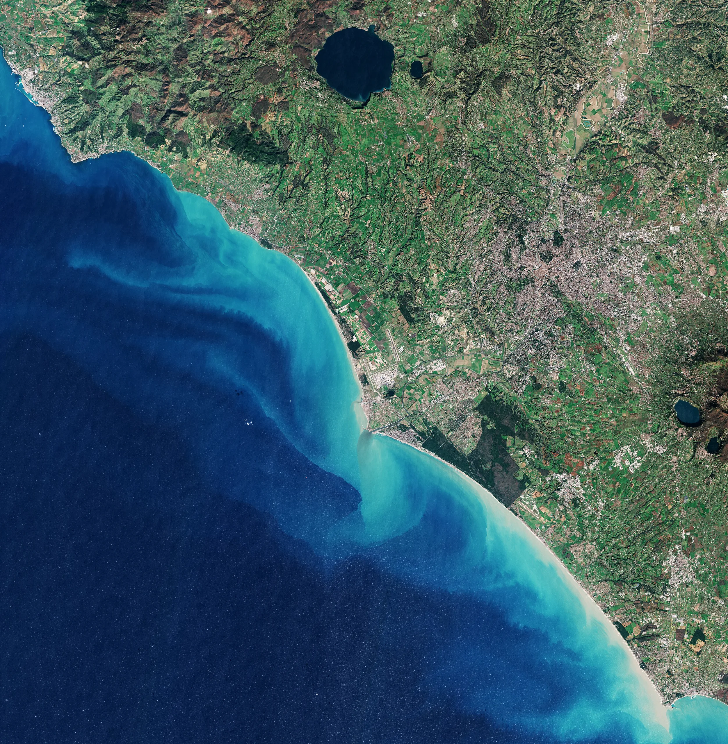
Copernicus Sentinel-2 satellite view of the Tyrrhenian coast around Rome, showing the city, farmland and sediment plumes in the sea

Community portals

Internal Organisation

The TCS Satellite Data consortium comprises a well-coordinated group of national and international research organizations dedicated to providing advanced Earth Observation (EO) products and services. These services focus on the analysis of Earth surface displacements and other solid Earth science applications. The consortium operates through National Research Infrastructures, ensuring the delivery of state-of-the-art satellite EO data, tools, and services for geohazards and georesources.


● 5 major research organizations.
● 9 distinct web services.
● Coverage across multiple European and extra-EU nations.
● Access to the latest EO satellite products.

LEADERSHIP

● Consortium Board Chair(s):
o Josè Fernandez (Consejo Superior de Investigaciones Científicas / Spanish National Research Council (CSIC)).
● TCS Director:
o Michele Manunta (Consiglio Nazionale delle Ricerche-Istituto per il rilevamento elettromagnetico dell'ambiente (CNR-IREA)).

CONSORTIUM COMPOSITION

● Member Organizations:
o France
National Centre for Scientific Research (CNRS).
o Italy
National Institute of Geophysics and Volcanology (INGV).
Consiglio Nazionale delle Ricerche-Istituto per il rilevamento elettromagnetico dell'ambiente (CNR-IREA).
o Spain
Consejo Superior de Investigaciones Científicas / Spanish National Research Council (CSIC).
o United Kingdom
University of London.

CONTACT

● Leadership:
o Michele Manunta

Read more

Governance

The TCS host organization is CNR (Italy), ensuring coordination among the partner organizations and oversight of operations. This involves facilitating collaboration between various stakeholders and ensuring that the EO services are tailored to user needs. The consortium operates within a cloud-based environment to maximize accessibility and user engagement, supported by systematic and on-demand processing capabilities.

Read more

Contact

Michele Manunta

Josè Fernandez

Consortium Board Chair

Member Organisation

5

Country

4

About Satellite Data

Want to know more?

Satellite Data is part of “Earth & Space Observation” thematic area. Read more about the thematic area or watch the next Thematic Core Service.

Earth & Space Observation — thematic area

Earth & Space Observation

Earth & Space Observation

Geomagnetic Observations

The TCS Geomagnetic Observations consolidates data and services provided by the geodetic community and creates new services for magnetotelluric data and geomagnetic models.

Geomagnetic Observations icon

Updates from “Satellite Data”

CONTACT

Got Questions on TCS Satellite Data?

We’ve got answers. Drop us a line. We’d love to talk.

Contact us